
Why Land Survey Cost Rises on Older Lots
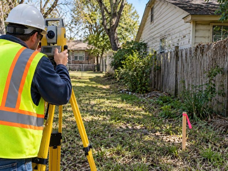
Two lots on the same street can look almost the same and still get very different survey quotes. The newer one might sit in a subdivision platted a few years ago, with fresh iron rods at every corner. The older one might trace back to a deed written generations ago, with a fence line nobody has questioned in decades. That history is what drives land survey cost up on older property. Once you know where the extra time goes, you can plan your budget and schedule with fewer surprises.
Older Property Records Can Require More Survey Research
Every boundary survey starts with research. The surveyor pulls the current deed, the recorded plat, and deeds for the neighboring lots. On a newer lot, that paper trail is short and usually clear.
Older lots are a different story. The surveyor may need to trace ownership back through many transfers to find the original description. Some records are handwritten, faded, or stored only on old microfilm. Others describe corners with things that no longer exist, like a large tree, a wooden stake, or a neighbor’s old barn.
Old deeds sometimes use measuring units that aren’t common anymore, such as chains or rods. The surveyor has to convert those numbers and figure out what the original writer meant. Each of these steps adds office hours, and office hours show up in the final price.
Conflicting Plats and Deeds Add Time to Survey Analysis
A plat is a recorded map that shows how land was divided into lots, streets, and easements. A deed is the legal document that transfers ownership and describes the property. On a clean newer lot, the two agree.
On older lots, they often don’t match. A plat might show a lot as 60 feet wide while the deed calls it 58 feet. A later replat may have shifted a line without every deed being updated. Neighboring deeds can also overlap or leave a thin gap between them.
The surveyor has to weigh all of this and decide where the boundary most likely sits. That takes careful analysis, and sometimes a call with the title company. The more conflicts there are, the more time the survey takes.
Longstanding Improvements Can Complicate Field Measurements
Improvements are anything built or placed on the land, like houses, garages, fences, driveways, sheds, and pools. Older lots tend to collect a lot of them over the years. Many were added without a survey.
These features can slow down fieldwork in real ways. Crews may need to measure around additions, carports, and tight side yards. Thick hedges and mature trees can block sight lines and GPS signals. A fence that has stood for 40 years may sit a few feet off the true line, and the surveyor needs to show exactly where it is.
What Crews Often Find on Older Lots
Some items come up again and again. Each one takes extra time to locate and show on the drawing. Common examples include:
- Fences that wander on or off the property line
- Sheds, carports, or additions close to the boundary
- Driveways or walkways shared with a neighbor
- Buried or bent corner markers under years of soil and roots
Older Lots May Require More Boundary Evidence to Reconcile Records
Boundary evidence is the physical proof a surveyor uses to locate a property line. It includes iron rods, concrete markers, old fences, and other features that match the record. On new lots, the corners are usually easy to find and match the plat well.
Older lots often have missing or disturbed markers. Construction, road work, and landscaping can bury them, move them, or pull them out entirely. The surveyor may need to search a wider area, dig, and use a metal detector to find anything useful.
When corners are missing, the crew may need to measure to monuments on nearby lots or down the block. They then compare that evidence to the records to rebuild the lost corners. This process is careful, slow work, and it’s one of the biggest reasons land survey cost goes up on older property.
Survey Scope and Site Complexity Shape the Final Cost
Survey scope means what the survey needs to include. A simple boundary survey costs less than one that also shows buildings, easements, flood zone data, or ground elevations. An ALTA survey for a commercial sale usually costs more because it follows a detailed national standard and often includes extra items.
Site conditions matter too. Lot size, tree cover, access, and how many neighbors share a line all play a part. A small corner lot with clear records may cost far less than a deep, narrow lot with old fences and no markers.
Before you order a survey, gather what you have. That can include your deed, any past survey, and your title commitment if you’re buying. Tell the surveyor why you need the survey and when you need it. Requirements can vary by lender, title company, and project type, so confirm what’s needed early if a closing, permit, or build depends on it.
Frequently Asked Questions
Why did my surveyor quote more for an older lot?
Older lots usually need more research, more field time, and more analysis. Records may be old, unclear, or in conflict with each other. Corner markers may be missing, and fences or buildings may sit near the line. Each of these adds hours, and those hours affect the price.
Can an old survey lower the cost of a new one?
An old survey can help, especially if it shows the corners the surveyor found and how the lines were set. It gives the new surveyor a head start on research and fieldwork. Still, the surveyor must check it against current conditions and records. It may lower the cost somewhat, but it rarely replaces a new survey.
Will my fence line be treated as the property line?
Not automatically. A fence is one piece of evidence, but it may not match the recorded boundary. The surveyor will show where the fence sits compared to the line. If there’s a gap or overlap, you may want to talk with the title company or a real estate attorney.
