↓
 

Houston Land Surveyor

Local Land Surveyors in Houston, TX

Houston Land Surveyor
  • Home
  • ALTA Survey
  • Boundary Surveying
  • Construction Survey
  • Drone LiDAR Mapping
  • Elevation Certificate
  • Land Surveying
  • Topographic Survey
  • Blog
  • Contact Us
Home 1 2 3 … 7 8 >>

Post navigation

← Older posts

Welcome to Houston Land Surveyor

Houston Land Surveyor Posted on August 18, 2017 by HoustonSurveyorMay 18, 2021

Your Final Stop for ALL of Your Survey Needs!                                         Contact us today for a free quote!

This site is intended to provide you with information on Land Surveying in the Houston, TX and Harris County area of Texas. If you’re looking for a Houston Land Surveyor, you’ve come to the right place. If you’d rather talk to someone about your land surveying needs, please call our local number at (281) 729 6832 today. For more information, please continue to read.

land surveyingLand Surveyors are professionals who make precise measurements to determine the size and boundaries of a piece of real estate.  While this is a simplistic definition, boundary surveying is one of the most common types of surveying related to home and land owners. If you fall into the following categories, please click on the appropriate link for more information on that subject:

Houston Land Surveyor services:

    1. I need to know where my property corners or property lines are. (Boundary Survey)
    2. I have a loan closing or re-finance coming up on my home in a subdivision. (Lot Survey)
    3. I need a map of my property with contour lines to show elevation differences for my architect or engineer. (Topo Survey)
    4. I’ve just been told I’m in a flood zone or I’ve been told I need an elevation certificate in order to obtain flood insurance or prove I don’t need it. (Flood Survey)
    5. I’m purchasing a lot/house in a recorded subdivision. (Lot Survey – See Boundary Survey if you’re not in a subdivision.)
    6. I’m purchasing a larger tract of land, acreage, that hasn’t been subdivided in the past. (Boundary Survey)

Contact Houston Land Surveyor services TODAY at (281) 729 6832.

Posted in boundary surveying, elevation certificate, land surveying, land surveyor | Tagged boundary survey, Houston Land Surveyor, land surveyor, land surveyor houston tx

ALTA Surveys Strengthen Due Diligence for High-Value Commercial Acquisitions

Houston Land Surveyor Posted on July 1, 2026 by HoustonSurveyorJune 30, 2026
Commercial retail property evaluated through an ALTA Survey during due diligence for a high-value real estate acquisition.

Buying commercial property is a major decision that involves large amounts of money and careful planning. Before finalizing any deal, buyers, lenders, and investors need to know exactly what they are getting. General maps or basic reports are often not detailed enough to show every important detail about the land and its features. ALTA surveys are created to meet strict national standards and provide a complete picture of the property. They help everyone involved understand the true condition, limits, and rights connected to the land, so the purchase is based on clear facts rather than assumptions.

How ALTA Surveys Support Investment-Level Property Evaluations

When evaluating a commercial property, teams look at many things to decide if it is a good investment. They review income potential, location, and legal records, but they also need to know exactly what exists on the ground. Old documents or simple sketches often miss small but important details that can change the value or use of the site.

An ALTA survey goes far beyond basic boundary checks. It records every visible and recorded feature of the property. This includes buildings, parking areas, utility lines, access points, and any restrictions or rights that affect the land. It matches what is written in legal papers to what is actually in place. This level of detail gives investors the full picture they need to make a fair and accurate assessment of the asset.

Identifying Physical Conditions That May Influence Asset Valuation

The value of a commercial property depends on more than just its size. Things like how easy it is to reach, where structures sit, and whether there are limits on how the land can be used all play a big role. A building that looks fine from the street may have part of its foundation crossing the property line, or a driveway that relies on permission from a neighbor. These issues can lower the value or cause problems later.

ALTA surveys clearly mark all these conditions. They show the exact position of buildings, fences, and paved areas. They also note easements, setback rules, and any agreements that let others use part of the land. Some of the key details they document include:

  • Exact location and size of all structures and improvements
  • Legal access routes and shared use areas
  • Overlaps or encroachments between properties
  • Zoning limits and restrictions on future use

With this information, buyers can see exactly what adds value and what could create costs or limits down the line.

Supporting Portfolio Acquisitions Across Multiple Commercial Properties

Many investors buy several properties at once as part of a larger strategy. When dealing with multiple sites, it is important to review each one in the same way so comparisons are fair and consistent. Using different types of surveys or reports for each property can lead to confusion and make it hard to judge the whole group.

ALTA surveys follow the same set of rules and standards everywhere they are done. This means each property is measured and described using the same method. Even if the sites are in different locations or have different uses, the information is presented in a uniform format. This makes it easier to compare risks, values, and potential across the whole portfolio. It also creates a reliable set of records that can be used for management, financing, or future sales.

Providing Reliable Property Data for Underwriting and Risk Assessment

Lenders and financial groups take a careful look before providing funds for large purchases. They need to be sure the property is safe, has clear ownership, and will hold its value. Missing or unclear information can lead to higher interest rates, lower loan amounts, or even a refusal to lend.

An ALTA survey supplies verified data these institutions require. It confirms boundaries, shows how the land is used, and reveals any legal or physical issues that could affect the investment. This information helps underwriters measure risk accurately. It reduces uncertainty and gives them confidence that the property matches its description. When the data is clear and complete, financing moves forward more smoothly and with fewer surprises.

Strengthening Decision-Making Before Capital Is Committed

A high-value commercial deal usually goes through many steps of review before any money changes hands. Every team involved from legal advisors to architects to financial analysts needs accurate information to do their work. If key details are missing or wrong, the whole plan may need to change later, which can cost time and money.

ALTA surveys provide verified information early in the process. They answer questions about boundaries, access, rights, and physical conditions right from the start. This lets all parties make decisions based on reality. It helps identify and solve problems while there is still time to adjust terms or plans. By removing doubt and confirming facts, the survey gives everyone the confidence to move forward with the investment.

Frequently Asked Questions

Why are ALTA Surveys important during high-value commercial acquisitions?

They provide a complete and accurate view of the property that meets strict standards. They reveal details that basic reports miss, such as boundaries, access rights, restrictions, and existing improvements. This helps buyers understand exactly what they are purchasing and reduces the risk of hidden issues.

How do ALTA Surveys support commercial property underwriting?

They give lenders and financial teams verified information about the property. This helps them measure risk, confirm value, and ensure the asset is free of major problems. Clear data makes it easier to approve loans and set fair terms for financing.

Can ALTA Surveys assist with portfolio acquisition reviews?

Yes. Because they follow the same national standards, each property in a portfolio is evaluated the same way. This creates consistent records that make it easier to compare assets, manage risks, and understand the overall value of the entire group of properties.

What types of property information are valuable during investment evaluations?

Investors need to know exact boundaries, location of buildings and utilities, access routes, restrictions on use, and any agreements that affect the land. ALTA surveys gather all these details in one document so nothing important is overlooked.

How do ALTA Surveys contribute to informed acquisition decisions?

They replace guesswork and old records with verified facts. This helps buyers spot risks, understand limits, and confirm value before committing funds. Having this information early makes the decision process clearer and reduces the chance of costly surprises after the sale is comple

Posted in ALTA Survey | Tagged alta survey

Boundary Surveying Provides Certainty as Property Lines Face New Development Pressure

Houston Land Surveyor Posted on June 29, 2026 by HoustonSurveyorJune 30, 2026
Surveying instrument on a construction site with excavation equipment in the background, illustrating boundary surveying to establish accurate property lines before new development.

When an area stays quiet and unchanged for many years, property lines often seem clear enough. People rely on fences, old markers, or just long-time use to know where their land begins and ends. But when nearby areas start to grow, build new homes, or expand businesses, everything changes. Land values go up, plans get more detailed, and small questions about lines can turn into big problems. Boundary surveying gives solid proof of exactly where each property stands. It removes guesswork and gives owners clear facts even as the world around them changes.

How New Development Activity Can Increase the Importance of Boundary Verification

In neighborhoods that have stayed the same for a long time, no one usually worries much about exact lines. There is plenty of space, and no one is trying to build close to the edge. But when new projects start nearby, rules become stricter and space becomes more valuable. Builders and planners need to know exactly where one lot ends and another begins.

Old records or memory are often not enough at this stage. Descriptions written decades ago may use landmarks that no longer exist, or measurements that do not match what is on the ground today. A boundary survey checks all these details. It compares legal documents to actual conditions and marks the true lines clearly. This work becomes more important as development picks up speed, because it prevents mistakes that could lead to disputes or legal issues later.

Documenting Existing Occupation Patterns Before Surrounding Land Changes

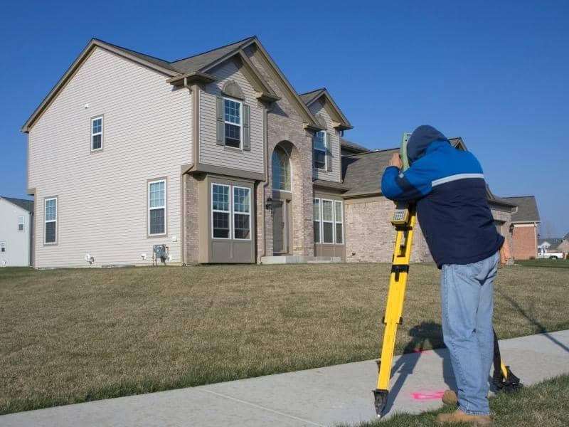
Over time, owners often build fences, put in driveways, lay out gardens, or create paths that mark how they use their land. These visible features may not always follow the exact legal line, but they become part of how the property is used and understood. When nothing changes around them, this usually causes no trouble.

When new development starts next door, however, these features suddenly matter more. A fence that was accepted for years might be questioned when a neighbor wants to build right up to the line. A boundary survey records all these existing conditions. It notes where fences, driveways, and other improvements sit compared to the true boundary. This creates an official record that shows how the land has been used, which helps avoid arguments when changes begin.

Some of the details it documents include:

  • Location of fences, walls, and hedges
  • Position of driveways, walkways, and parking areas
  • Areas used for storage, gardens, or other daily activities
  • Any gaps or overlaps between what is used and what is legally owned

Having this information written down early protects everyone involved.

Supporting Property Owners as Adjacent Construction Expands

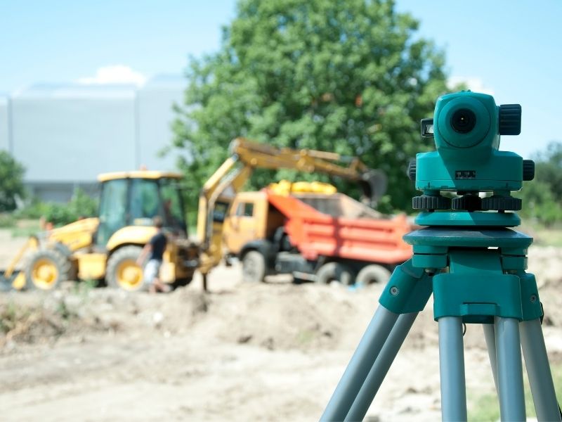
When construction starts on a neighboring lot, there is a lot of activity going on at the edge of the property. Heavy equipment, digging, and material storage all take place close to the line. If no one knows exactly where the boundary is, it is easy for work to accidentally cross over. This can damage trees, fences, or even parts of the land itself.

A boundary survey marks the exact lines with visible stakes or markers before any work begins. Both the owner and the construction crew can see clearly where they must stop. This prevents mistakes and gives everyone a shared point of reference. If questions come up later about access, damage, or placement, the survey report serves as fair proof of where the limits lie. It turns possible conflict into clear understanding.

Establishing Reliable Reference Information for Future Land Use Decisions

As an area grows, owners often start thinking about their own plans. They may want to add a room, build a garage, divide the lot, or sell part of the land. To do any of these things, they need to know exactly how much space they have and where it ends.

Without accurate boundary information, every decision is based on guesses. A plan that looks good on paper might not fit the actual size of the lot. A boundary survey creates a fixed, trusted reference point that can be used for years. It becomes the standard for all future plans. Whether the owner wants to improve the property, apply for permits, or explore new options, they can do so with confidence that they are working within their true limits.

Reducing Uncertainty as Property Values and Development Interest Increase

When an area becomes popular for development, land becomes more valuable. This also means that every foot of property matters more. What used to be considered a small difference in measurement can now make a big difference in worth or what can be built.

Uncertainty about boundaries can lower a property’s value or make it harder to sell, insure, or finance. Buyers and lenders want proof that the land matches its description. A boundary survey provides that proof. It shows exactly what belongs to the owner and removes any doubt. In times of change and growth, having this certainty makes it easier to make decisions, protect investment, and move forward without worry.

Frequently Asked Questions

Why does increased development activity create a need for boundary surveying?

As more building happens nearby, space becomes more valuable and rules become stricter. Old assumptions or unclear records are no longer enough. A survey gives exact proof of lines, which prevents mistakes, disputes, and legal problems as the area changes.

What are occupation patterns and why do they matter?

Occupation patterns are the ways people use their land over time, such as where fences, driveways, and gardens are placed. When new development starts, these features can be questioned. A survey records them clearly so everyone understands how the land has been used and where true limits lie.

How can boundary surveying help property owners near active construction projects?

It marks clear lines so construction crews know exactly where they can work. This prevents damage or crossing into the wrong area. If questions or disagreements come up, the survey report serves as objective proof of where the property begins and ends.

Why is accurate boundary information valuable when surrounding land uses change?

It gives owners a solid base for their own plans. Whether they want to build, expand, or sell, they need to know exactly how much land they have. It also protects their investment and makes sure the property stays clear and valuable as the area grows.

How does boundary surveying reduce uncertainty during periods of rapid development?

It replaces guesswork and old descriptions with exact measurements and official records. This removes doubt about where lines are, reduces the chance of conflict, and lets owners make decisions with full confidence even as changes happen all around them.

Posted in boundary surveying | Tagged boundary surveying

How Boundary Surveys Help Houston Property Owners Navigate Split Ownership and Legacy Family Tracts

Houston Land Surveyor Posted on June 26, 2026 by HoustonSurveyorJune 25, 2026
Land surveyor performing a boundary survey to help property owners clarify land lines and ownership records.

Some Houston families have held onto the same land for fifty or sixty years. Grandparents bought it, parents inherited it and now several cousins or siblings share ownership without anyone being completely sure where the lines are. That situation is more common than people think, and boundary surveys are often the first step toward sorting it out before it turns into a real problem.

Reconstructing Property Histories That Span Multiple Generations

Old family land comes with old paperwork. Deeds written decades ago used different language, different reference points and sometimes descriptions that are nearly impossible to follow today. “Beginning at the old oak tree” doesn’t mean much when the oak tree is gone.

When land passes through two or three generations, the records get thinner each time. Relatives pass away. Files get lost. What the original owner knew about the property boundaries lived in their head, not in any document anyone can find now.

A boundary surveyor goes back to the original legal descriptions and recorded documents and works forward from there. They locate physical evidence on the ground, iron pins, fence lines, old stone markers, and match that evidence against the written record. The result is a clear picture of where the land actually starts and stops, based on real research rather than family memory.

This kind of work takes longer on old properties. But it’s the only reliable way to understand what the family actually owns before making any decisions about the land.

Understanding How Partial Ownership Interests Can Affect Land Use Decisions

Shared ownership gets complicated fast. Four siblings inherit a 200-acre tract. One wants to lease a section to a farmer. Another wants to build a small house on the back portion. A third is thinking about selling their shares. None of them can move forward confidently without knowing exactly what the property looks like and where everything sits.

Boundary information gives everyone at the table the same starting point. It shows the full size of the tract, where access points are and how the land lays out across the whole parcel. Decisions about leasing, building or selling become much easier to discuss when all owners are looking at accurate measurements rather than guessing.

Without that shared reference, conversations about the property tend to go in circles. Everyone has a slightly different idea of what the land includes, and those differences cause friction that gets worse over time.

Clarifying Boundaries When Family Land Has Been Used Differently Over the Years

Large family tracts rarely get used the same way across every acre. One corner might have a house on it. Another section has been farmed for thirty years. Part of it is wooded and nobody goes back there much. Old storage buildings sit along one fence line from a business the family ran decades ago.

All of that history leaves marks on the land. Fences get moved. Structures go up in spots that made sense at the time. Roads get worn into the ground that have no legal status but have been used so long they feel permanent.

A boundary survey shows how all of those uses fit within the actual legal limits of the property. That matters when family members disagree about which areas belong to which portion of the tract, or when someone wants to do something new and needs to know if they’re working within their own land or crossing into another section.

Some of the things a survey helps clarify on long-held family properties:

  • Where old fences sit relative to the actual property line
  • Which structures fall inside the legal boundary and which might not
  • How access roads or driveways cross the tract and whether they connect to a public road
  • Where a creek, pond or drainage feature sits in relation to the boundary

Supporting Attorneys, Appraisers, and Other Professionals Working With Legacy Properties

When a family decides to do something formal with inherited land, a lot of professionals get involved. An estate attorney needs to understand what’s being transferred. An appraiser needs accurate acreage and boundary information to value the property. A lender financing a purchase needs documentation of what’s actually there.

All of these people work better when accurate boundary information already exists. An attorney drafting a deed can describe the property correctly. An appraiser doesn’t have to estimate acreage from an old tax record that may not reflect reality. A lender can review a survey instead of asking questions nobody can answer.

Without a current boundary survey, each of these professionals has to work around the gap. That slows things down and sometimes raises questions that stop a transaction entirely while someone tries to find information that should have been documented years ago.

Creating Reliable Records for Future Generations and Long-Term Stewardship

Family land rarely stays with one generation. Eventually it passes again, and the people who inherit it may know even less about it than the current owners do. They’ll have the same questions. Where exactly is the line? What does the family actually own? What are the access points?

A boundary survey done today answers those questions for whoever comes next. The documentation doesn’t expire. A survey completed now will still be a useful starting point for the next generation, even if some additional verification is needed decades from now.

Families that invest in clear records tend to have fewer ownership disagreements over time. The information is there. Everyone can see it. Decisions about the land can be made from facts rather than from competing versions of what various relatives remember being told years ago.

That kind of documented clarity is one of the more practical things a current generation can leave behind for the people who will eventually inherit what they’ve held onto.

Frequently Asked Questions

Why are boundary surveys important for legacy family properties?
Boundary surveys provide accurate information that helps owners understand the size and location of land that has been held for many years.

Can a boundary survey help when multiple family members own the same property?
Yes. Boundary information gives all owners a shared understanding of the property’s layout and limits.

Who may use the information shown on a boundary survey?
Property owners, attorneys, appraisers, lenders, estate planners and future buyers may all rely on survey information.

Is a boundary survey useful even if the property has stayed in the family for decades?
Yes. Older properties often benefit from updated records that reflect current conditions and ownership needs.

Can different parts of a family tract be used for different purposes?
Yes. Large properties may support residential, agricultural, recreational or other uses across various sections of the land.

How do boundary surveys help future generations?
Boundary surveys create reliable records that help future owners better understand and manage inherited property.

Posted in boundary surveying | Tagged boundary survey

Post navigation

← Older posts
Get Quote Button
© Boxer Survey USA
Houston Land Surveyor

Houston, Texas
Phone: (281) 729 6832

Web Development and SEO by:
AuburnBusiness.com, LLC


Privacy Policy | Terms of Use

The owner of this website, Boxer Survey USA, provides coordination of professional land surveying and engineering services in all 50 states. The professional surveying and engineering services provided to you will be conducted by fully licensed professionals in your state.

↑